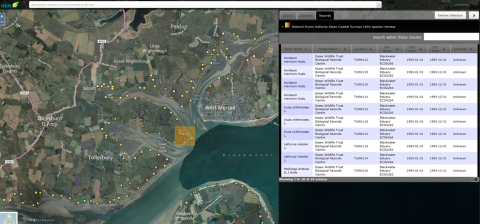
Essex Wildlife Trust was awarded funding from Natural England in early 2015 to digitise Essex coastal data for the Blackwater and Colne Estuary, collected by the National Rivers Authority in the early 1990s. This is part of our ongoing partnership work with Natural England and the Environment Agency.
The data consisted of sketch maps, photographs and botanical surveys that were part of a detailed survey of the Essex coast. Essex Wildlife Trust Biological Records Centre has digitised this historic data and uploaded it to the National Biodiversity Network Gateway. The dataset consists of over 1400 records of priority saltmarsh plants recorded around the Estuary and is available to all users of the Gateway at full resolution.
This data will be particularly useful in informing work on the Blackwater Estuary Marine Conservation Zone, as it will act as a baseline for further survey work on the MCZ by our Living Seas officer and partner organisations. It also complements the recent river walkover surveys and historic river corridor data that is already available via Essex Wildlife Trust Biological Records Centre, and which is used to inform our partnership working to achieve the standards set out in the EU Water Framework Directive. For more information on the datasets held by Essex Wildlife Trust please click here: http://www.essexwtrecords.org.uk/info.
The National Rivers Authority Coastal dataset for the Blackwater and Colne Estuary can be accessed here via the NBN Gateway. More information on recent walkover surveys and our partnership working can be found on the Essex Rivers Hub, http://www.essexrivershub.org.uk/.
