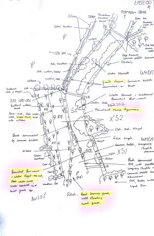
Essex Wildlife Trust Biological Records Centre has recently secured funding from the Environment Agency to digitise historic river corridor data for Essex and make it available to others. This builds on our previous work to digitise old National Rivers Authority data and adds to our knowledge of the character of river catchments in Essex.
In August 2017 we signed a data exchange agreement to receive a van load (literally!) of data from Colchester and Ipswich Museum, and on closer examination we discovered that it contained a dataset of river surveys from the 1990s on the River Colne, Roman River and tributaries. The dataset was similar to data that we had previously digitised for the Rivers Pant and Blackwater (details here), so the Environment Agency have agreed to provide funding to make this dataset available as well in digital form. The paper records have now been scanned and the dataset is in the process of being digitised, after which it will be made available on the NBN Atlas.
